Two roads diverged in a wood, and I--
I took the one less traveled by,
And that has made all the difference.
~Robert Frost


Friday, November 12, 2010

Trail Tale 1: Lindner Park, McCullough Estate Nature Preserve, November 2010

One day about a year ago, I stumbled upon this little gem of a nature preserve on the border of Norwood and Pleasant Ridge while taking a round-about way home from a lunch date.  I was hoping the ride would lull the boys into a nap, but we ended up exploring the trails instead.  I am somewhat familiar with the city of Norwood (I worked at the local library and later rented an apartment there for about a year), but I hadn't explored the area north of the Lateral where Lindner Park is located on a sleepy side street which features some really neat old homes, including those once occupied by members of the McCullough family.  So, finding this lovely and historically interesting site felt like I'd just discovered a secret treasure--of course, most of the hikes this year have felt that way since they are all new to me.


On a sunny Friday this past November, I took the boys back to Lindner Park to capture some photos for this blog entry and enjoy the beautiful day.  The inviting entrance to the park is off of Cypress Way.


A small paved parking lot is down the driveway, past the historic McCullough House, and on the left.  A very nice, shady picnic area is located at the end of the driveway near the parking lot with fairly new picnic tables, trash cans, and a working water fountain.  I did not get a photo of the picnic area for some reason, but this is the view from that spot looking toward a formal garden and the house beyond.


We found the restrooms in the building shown below, to the left of the garage doors.  In this view the picnic area is on the right, the house is on the left, and the woods are to my back.


Turning around, we found a trail head to the woods beside a bench overlooking the gardens.  After a quick snack and trip to the restroom, the boys were ready to go!


[NOTE:  This hike is divided into two posts--this post covers the Pawpaw trail at Lindner Park and the following post will describe the Cypress Trail.]


Just a few yards into the hike, we came to the first of several spectacular big trees.  These really stand out in comparison to the smaller, newer trees which make up much of these woods.


Some are nicely labelled, as you can see with this American Sweetgum:


And here we go down the trail...


Soon into the walk, we pass by the remnants of some old structures on the property...


...and quickly encounter a brand-new structure.  This sturdy fence protects hikers from a drop in the landscape and runs alongside the trail. 


It's hard to keep two active boys from climbing the fence, though I did succeed in keeping their climbs to a minimum.


The view is over a small ravine containing a creek and the trail eventually descends to that point.  A big Sycamore looms up from the ravine and I can't help but notice my shadow in it's trunk as I lean onto the fence.  Can you see it?
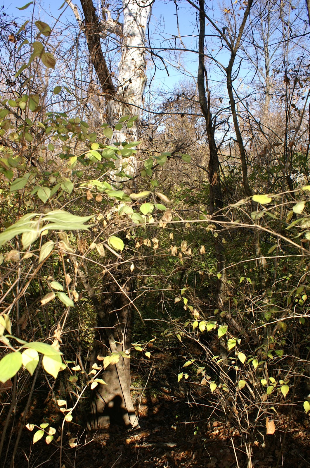

The trail continues on a little ways before it dips down toward the creek.  It's a bit steep and my 2 year old needed some help, but there are plenty of roots to serve as footholds.  The photos below give you an idea.


Shortly after the descent, we come to the first of two foot bridges (no handrails) crossing the small creek--always a point of interest for the kids.


Soon after the bridge we make a huge discovery--Nature's Own Jungle Gym!!

Welcome to the Jungle Gym

Enjoy Your Stay

Use Caution While Climbing

All Sticks Must Remain in the Play Area

Please Do Not Swing on the Vines

Benches Are Provided for Resting

Come Back Soon!

I took a ton of pictures of the boys at this awesome little nook in the woods created by a fallen tree.  These are only a select few--I could add more, but then I'd be gushing.  It was a lot of fun though and certainly a feature to enjoy.  On down the trail, you walk alongside the creek, which was very dry as all the creeks have been this year.  Soon we came to the second foot bridge.


Here is where a hint of sewage invaded the air.  It is known, according to the park brochure, that "Unfortunately, the creek receives sewer water from Cincinnati and at times can be an unpleasant place to be."  Yep.  It wasn't overpowering on this day, but still, we didn't linger for very long.  We made our way along the other side of the creek and eventually up some stone steps that took us back up to the restrooms and parking lot.


This completed our venture on the Pawpaw Trail.  With our stop and spontaneous photo shoot at the "jungle gym", this portion of the walk took us 35 minutes.  We decided to continue our hike on the Cypress Trail. Please see the entry which follows for the description of the Cypress Trail!

Trail Tale 2: Lindner Park, McCullough Estate Nature Preserve, November 2010

[This begins the second part of our hike at Lindner Park on the Cypress Trail.  Please see part one for a more detailed description of the park in general]. 

After a pit stop at the restroom, the boys were still full of energy, so we continued exploring the park, this time taking the same trail head, but turning right at the fork toward the Cypress Trail.  We were in for a treat!  This is where all the historical structures were awaiting our discovery.  

  Here we go again!

Again, we were greeted by a big, bold, beautiful tree:


Look how tiny my child looks in comparison.  Wow!    


Just ahead, we come upon this interesting structure:


This building is a bath house for the family and guests of the McCullough's who came to use the pool on the property.  Pool?  What pool?  


Well, this one, of course!  I found a nice photo of the way it used to be in the book Norwood by Christine Mersch (click on the book title to see the photo and others from Google Books).  Of course, it is no longer in use, but the boys found a way to enjoy the pool anyway.  


This is an interesting view from behind the bath house posts:


The structure is made of Cypress logs, brought from Florida, according to the park's brochure.  After the boys romped on, in, and around the pool for awhile, we ventured on, viewing more interesting trees:


and finally finding the ultimate leaf pile which Miles thoroughly enjoyed:


It is too bad we were not here just a couple weeks earlier when autumn's colors were on full display!  

Heading back the way we came, toward the pool, we continued our hike in search or more relics, like this old sign for the J.C. McCullough Seed Company:


We encountered another really cool tree that looks kind of like a pitch fork:


Next we came to an old spring house which is built with stone and cypress like the bath house.  In the park brochure, it is written, "The spring house was used as an ice house for storing food before the days of refrigeration...Observe that the spring comes through the floor of the house."


Soon after, we reached the end of our hike and, uh...the beginning of the trail.  Oops!


Although I don't think it is necessary to start at the beginning here at Lindner Park since all the trails begin and end near one another, it may be more enjoyable, especially if you can get a brochure to read as you encounter the different structures along the way.  For us, it worked out to end at the beginning where we could take a rest on a bench and relax in front of the Lily Pond (complete with fish).


I also happened to meet the park attendant who lives on site.  We chatted a bit and she gave me the lovely brochure for the park which is full of interesting info about the park and it's history.  With all the big, beautiful trees at this park, autumn is a great time for a visit.  But, I look forward to visiting again in spring and summer when the formal gardens on site will really be blooming.  Look for a future post to highlight the gardens.  This is definitely one of my go-to spots for when the boys and I need some outdoor fun.  It's close to home, but still feels so remote.  I just hope the boys don't think we can actually swim in the old pool, but we can always pretend!  

Wednesday, October 20, 2010

Fast Facts: Stanbery Park

2221 Oxford Avenue
Cincinnati, OH  45230
http://cincyparks.com/parks-events/east-region/stanbery-park/
http://www.mwcc.org/hist.html#stanbery


View Larger Map

Kids Will Like
  • Playground
  • Hiking Trails
  • Tossing Stones into the Creek Bed
  • Climbing on Fallen Trees
  • Open Field for Playing Tag

Good to Know
  • No Admission Fees
  • Paved Parking Lot
  • Restroom Rating:  A
  • Stroller-friendly Paved Path
  • Trail Information
    • Trail Maps Not Available On Site, Download Here: http://www.cincinnatiparks.com/bm~doc/trail-map-stanbery-park.pdf
    • Not Stroller-Friendly
    • Semi-Rough Terrain
    • Some Steps Along the Way
    • Small Bridges Are Well-Constructed
    • Trail Follows Creek and Crosses at One Point
    • Trail is Long, but Contains Several Off-Shoots Leading Back to the Playground
Synopsis
Located in the heart of Mt. Washington, this park provides a respite from the hubbub of busy Beechmont Avenue.  You can easily come for the playground and a quick stroll along the paved path or head down the trail for a deep woods experience which you would never guess existed if you are normally just a passerby of the area.     

Historical Information
Mt. Washington: http://www.mwcc.org/hist.html
General Stanbery: http://militarytimes.com/citations-medals-awards/recipient.php?recipientid=18205


Tuesday, October 19, 2010

Trail Tale: Stanbery Park, October, 2010

Who knew?  I had no idea that a deep woods hiking experience existed just behind the multiple storefronts of the Mt. Washington business district along busy Beechmont Avenue.  I thought Stanbery Park was a good place for someone to take a lunch break--which it is--but was not prepared for a miniature Rowe Woods-like trail that kept us going for a good hour and a half.  On this crisp, early-autumn day, the boys and I met my friend Holly and her son, John Ethan to first check out the playground and then venture into the woods.  We located the trail head behind the playground after a bit of a false start.  Tip:

This
is NOT the trail head.  This nice little path leads you out to the street. Oops.

This, however

IS the trail head.  See the arrows, the green letter A, the word "Trail"?  Okay.  Now that we have that straight, let's see what lies ahead.


From the moment you step onto the trail, the Big Trees command your attention.  Here, the boys are trudging down the path toward a tall tree in the distance. Marshall is taking the lead, John Ethan next, and Miles bringing up the rear--it's like they've lined up according to age, a natural pecking order established from the get-go. 

And here, the fearless leader discusses the presence of tiny insects hiding in the ridges of the tree bark while the young'uns look on. C'mon, this is just too cute.


About five minutes into the hike, we encountered a set of steps that took us closer to the creek bed.  There are several sets of steps and bridges along the way that are all well-constructed and pretty easy to navigate.  Here I'm looking back at the first set:


From this point, the trail follows the creek bed most of the way and eventually crosses over, if you happen to get that far.  It's amazing how dry the creek is.  I'd love to see what it looks like when it's full of water!  


The boys don't seem to mind the dry conditions, however.  The dusty path becomes a canvas for hand-print art:


Stones tossed into the creek bed create a musical sound:


John Ethan is wondering, "What sound will this HUGE stone make?"


Besides their impressive size, the big trees also caught our attention with their root displays.  There are quite a few of these obstacle courses along the trail


and fallen trees which make good climbing structures:


After all the dirt painting, stone throwing, and tree scaling, the boys took advantage of one of the bridges for a quick rest and contemplation period:
 
This photo courtesy of Holly P.

Several well-constructed bridges help to keep the trail passable, but caution should be taken as there are some steep edges or drop-offs at these points.  An unsuspecting child could easily lose their balance, even on those bridges with railings.

As the pictures show, the trails are nicely maintained.  Although most trees that have fallen across the path are cut to keep it clear for hikers, we eventually came to what seemed to be the end of the trail.  Several large trees were down and the path just stopped--only the dry creek bed lay beyond the barrier. 


Under normal circumstances, when the creek contains water, this may well have been the end of our hike.  Or, perhaps stones would have made a natural path through the stream.  If you do come to this point in the hike and you (or the kids) are feeling a little tired and wondering how much further to go, I recommend turning back and taking one of the set of steps you passed along the way.  You will see a marker with the word "shelter" and arrow pointing the way, like the one in the following photo:


Marshall had the right idea in heading toward the shelter and we probably should have followed along.  But no, seeing the trail on the opposite bank, we ventured into the creek bed where the kids could add rock climbing to their list for the day.


And here begins the last leg of the trip. 


At this point, we are about 45 minutes into the hike.  Yep, should've followed the sign pointing to the parking lot.  Once we crossed the creek, the trail stayed pretty much the same.  After a quick pit-stop (and photo-op),
Marshall takes a break.
Holly and I spent the rest of the hike trying to convince the boys they didn't really need to be carried down the trail and convince ourselves that there was an actual end to this hike. After spotting a couple of deer trotting up the wooded hillside, the only wildlife we noticed during the whole hike, we finally found the light at the end of the tunnel!


We emerged from the woods to find a very welcoming bench sitting on the paved path and overlooking the meadow we had just passed through.  We saw dog walkers and more people at the playground, but we never encountered another person on the trail.  Maybe it was too chilly that day, or maybe it was just the day of the week, or maybe people are just not aware of the urban wilderness that awaits just behind the banks, restaurants, and shops of Mt. Washington.  Well, now you know!